
Carte topographique Glasgow
Carte interactive
Cliquez sur la carte pour afficher l’altitude.
Glasgow
According to the United States Census Bureau, the city has a total area of 1.43 square miles (3.7 km2), all of it land. The town has an elevation of 2,093 feet (638 m) and is nestled in the Milk River Valley.
À propos de cette carte
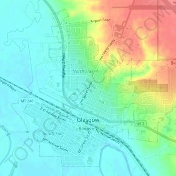
Nom : Carte topographique Glasgow, altitude, relief.
Lieu : Glasgow, Valley County, Montana, 59230, United States (48.18836 -106.65042 48.21255 -106.61272)
Altitude moyenne : 654 m
Altitude minimum : 633 m
Altitude maximum : 700 m