
Carte topographique Jaco
Carte interactive
Cliquez sur la carte pour afficher l’altitude.
À propos de cette carte
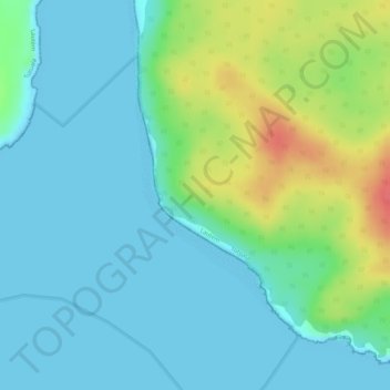
Nom : Carte topographique Jaco, altitude, relief.
Lieu : Jaco, Tutuala, Lautém, East Timor (-8.44535 127.30831 -8.42601 127.31953)
Altitude moyenne : 17 m
Altitude minimum : 0 m
Altitude maximum : 62 m
The island is low-lying, with an area of 11 km2 (4.2 sq mi) and a maximum elevation of about 100 m (330 ft). It is covered mainly by tropical dry forest, fringed by strand vegetation and sandy beaches. There are some low cliffs on the southern coast.