

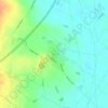
Carte topographique Halloughton
Cliquez sur la carte pour afficher l’altitude.
Halloughton
The village stands at an altitude of about 65 metres (213 ft). Its population is included with Southwell's. It lies just to the north of Halloughton Dumble, a wooded valley, some 3 miles (5 km) from the River Trent at Bleasby.
À propos de cette carte

Nom : Carte topographique Halloughton, altitude, relief.
Altitude moyenne : 64 m
Altitude minimum : 15 m
Altitude maximum : 104 m
Autres cartes topographiques
Cliquez sur une carte pour visualiser sa topographie, son altitude et son relief.
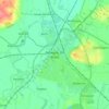
Newark on Trent
United Kingdom > England > Nottinghamshire > Newark and Sherwood
Altitude moyenne : 18 m
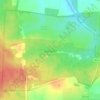
Sherwood Forest NNR
United Kingdom > England > Nottinghamshire > Newark and Sherwood > Ollerton
Altitude moyenne : 71 m
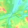
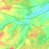
Kings Clipstone
United Kingdom > England > Nottinghamshire > Newark and Sherwood
Altitude moyenne : 81 m
Danethorpe Hill
United Kingdom > England > Nottinghamshire > Newark and Sherwood
Altitude moyenne : 22 m
Farndon
United Kingdom > England > Nottinghamshire > Newark and Sherwood > Farndon
Altitude moyenne : 14 m

Blidworth Bottoms
United Kingdom > England > Nottinghamshire > Newark and Sherwood > Blidworth CP
Altitude moyenne : 107 m
Goverton
United Kingdom > England > Nottinghamshire > Newark and Sherwood > Bleasby
Altitude moyenne : 34 m
Vicar Water Country Park
United Kingdom > England > Nottinghamshire > Newark and Sherwood > Clipstone
Altitude moyenne : 97 m
Spalford Warren
United Kingdom > England > Nottinghamshire > Newark and Sherwood > Spalford
Altitude moyenne : 7 m
Sherwood Forest NNR
United Kingdom > England > Nottinghamshire > Newark and Sherwood > Ollerton
Altitude moyenne : 71 m