
Carte topographique Los Alamos
Carte interactive
Cliquez sur la carte pour afficher l’altitude.
À propos de cette carte
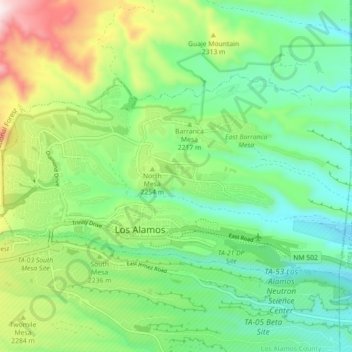
Nom : Carte topographique Los Alamos, altitude, relief.
Altitude moyenne : 2’196 m
Altitude minimum : 1’990 m
Altitude maximum : 2’638 m
Los Alamos is located in northern New Mexico between the Rio Grande and the eastern rim of the Valles Caldera on the Pajarito Plateau, approximately 35 mi (56 km) to the northwest of Santa Fe. The elevation at the post office is 7,320 feet (2,230 m) and total land area is 11.14 square miles (28.9 km2).