
Carte topographique Krupanj
Carte interactive
Cliquez sur la carte pour afficher l’altitude.
Krupanj
The town lies in western Serbia, at the southern border of the Pannonian plain and Mačva region. It is surrounded by the mountains Jagodnja, Boranja and Sokolska planina, in a valley intersected by several rivers and creeks. In the town itself, the rivers Bogoštica, Čađavica and Kržava conjoin into Likodra, which later empties into Jadar. The town lies at the altitude of 280 m.
À propos de cette carte
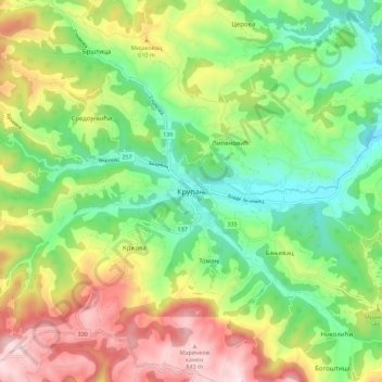
Nom : Carte topographique Krupanj, altitude, relief.
Altitude moyenne : 484 m
Altitude minimum : 229 m
Altitude maximum : 876 m