
Carte topographique Wyoming
Carte interactive
Cliquez sur la carte pour afficher l’altitude.
À propos de cette carte
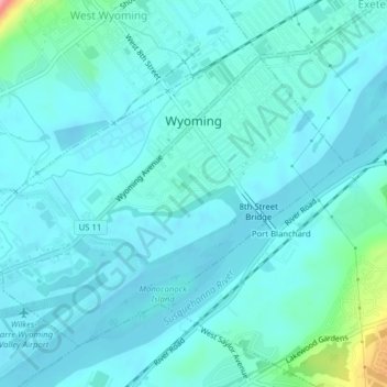
Nom : Carte topographique Wyoming, altitude, relief.
Lieu : Wyoming, Luzerne County, Pennsylvania, United States (41.29455 -75.86141 41.31773 -75.82214)
Altitude moyenne : 174 m
Altitude minimum : 159 m
Altitude maximum : 270 m
The flood of 2011 prompted the evacuation of the Wilkes-Barre Wyoming Valley Airport (in southern Wyoming). The planes were moved to a higher elevation to prevent flood damage; they were relocated to the Wyoming Monument.