
Carte topographique Castle Ward
Carte interactive
Cliquez sur la carte pour afficher l’altitude.
À propos de cette carte
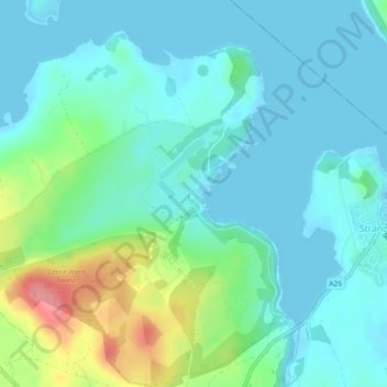
Nom : Carte topographique Castle Ward, altitude, relief.
Altitude moyenne : 22 m
Altitude minimum : -1 m
Altitude maximum : 96 m
Autres cartes topographiques
Cliquez sur une carte pour visualiser sa topographie, son altitude et son relief.
Kilclief Castle
United Kingdom > Northern Ireland > Strangford
Kilclief Castle, A2, Kilclief, Strangford, County Down, Northern Ireland, BT30 7PA, United Kingdom
Altitude moyenne : 5 m