
Carte topographique Antofalla
Carte interactive
Cliquez sur la carte pour afficher l’altitude.
À propos de cette carte
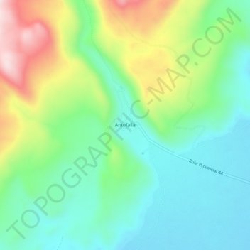
Nom : Carte topographique Antofalla, altitude, relief.
Altitude moyenne : 3’482 m
Altitude minimum : 3’344 m
Altitude maximum : 3’775 m
Antofalla and other Andean volcanoes form because the Nazca Plate is subducting beneath the South American Plate. Antofalla volcano is located in a region with a "basins and ranges" topography, where during the Miocene ranges were uplifted and basins formed through tectonic movement. It sits on a basement formed by Eocene-Miocene sedimentary units over a much older crystalline basement.