
Carte topographique Hall
Carte interactive
Cliquez sur la carte pour afficher l’altitude.
À propos de cette carte
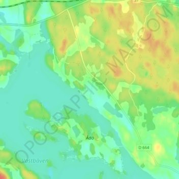
Nom : Carte topographique Hall, altitude, relief.
Lieu : Hall, Flens kommun, Södermanland County, 649 91, Sweden (59.02769 16.74716 59.06769 16.78716)
Altitude moyenne : 36 m
Altitude minimum : 19 m
Altitude maximum : 66 m
Autres cartes topographiques
Cliquez sur une carte pour visualiser sa topographie, son altitude et son relief.
Katrineholm
Katrineholm, Katrineholms kommun, Södermanland County, 641 46, Sweden
Altitude moyenne : 48 m
Eskilstuna
Eskilstuna, Eskilstuna kommun, Södermanland County, 632 27, Sweden
Altitude moyenne : 27 m
Nyköping
Nyköping, Nyköpings kommun, Södermanland County, 611 33, Sweden
Altitude moyenne : 19 m