

Carte topographique Long Pond
Cliquez sur la carte pour afficher l’altitude.
Long Pond
Long Pond is named after the wetland topography formed by Tunkhannock Creek. Within the Long Pond community are public access lands, containing many species of plants and animals. Long Pond has been called "the most unique inland freshwater wetland in the state".
À propos de cette carte
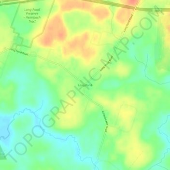
Nom : Carte topographique Long Pond, altitude, relief.
Altitude moyenne : 571 m
Altitude minimum : 550 m
Altitude maximum : 596 m
Autres cartes topographiques
Cliquez sur une carte pour visualiser sa topographie, son altitude et son relief.
Indian Mountain Lake
United States > Pennsylvania > Monroe County > Tunkhannock Township > Indian Mountain Lake
Altitude moyenne : 506 m

Indain Mountain Lake Beach
United States > Pennsylvania > Monroe County > Tunkhannock Township > Indian Mountain Lake
Altitude moyenne : 560 m