
Carte topographique State Center
Carte interactive
Cliquez sur la carte pour afficher l’altitude.
À propos de cette carte
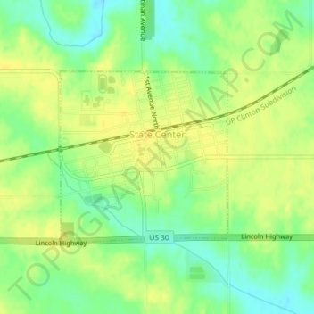
Nom : Carte topographique State Center, altitude, relief.
Lieu : State Center, Marshall County, Iowa, United States (42.00734 -93.17500 42.02215 -93.15552)
Altitude moyenne : 322 m
Altitude minimum : 308 m
Altitude maximum : 331 m
Autres cartes topographiques
Cliquez sur une carte pour visualiser sa topographie, son altitude et son relief.
Marshalltown
United States > Iowa > Marshall County
Marshalltown, Marshall County, Iowa, 50158, United States
Altitude moyenne : 283 m
Saint Anthony
United States > Iowa > Marshall County > St. Anthony > Saint Anthony
Saint Anthony, St. Anthony, Marshall County, Iowa, 50239, United States
Altitude moyenne : 317 m
Albion
United States > Iowa > Marshall County > Albion
Albion, Marshall County, Iowa, United States
Altitude moyenne : 285 m