
Carte topographique Kashan
Carte interactive
Cliquez sur la carte pour afficher l’altitude.
À propos de cette carte
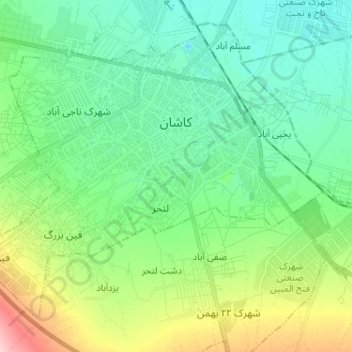
Nom : Carte topographique Kashan, altitude, relief.
Altitude moyenne : 964 m
Altitude minimum : 910 m
Altitude maximum : 1’112 m
Kashan has a hot desert climate with cold winters (although warmer than other Iranian cities) and hot, sometimes very hot summers. Kashan is significantly warmer than other cities in the Iranian Plateau due to its lower elevation. Its climate is somewhat similar to Qom.
Autres cartes topographiques
Cliquez sur une carte pour visualiser sa topographie, son altitude et son relief.
Khorram Dasht RD
Iran > Isfahan Province > Kashan County
Khorram Dasht RD, Kashan Central District, Kashan County, Isfahan Province, 81456-14117, Iran
Altitude moyenne : 1’338 m