
Carte topographique H500
Carte interactive
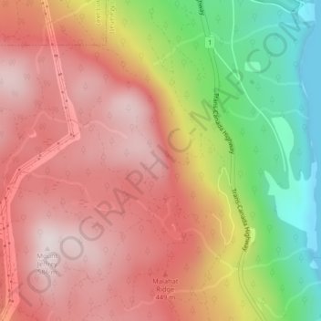
Cliquez sur la carte pour afficher l’altitude.
À propos de cette carte
Nom : Carte topographique H500, altitude, relief.
Altitude moyenne : 341 m
Altitude minimum : 0 m
Altitude maximum : 574 m
Autres cartes topographiques
Cliquez sur une carte pour visualiser sa topographie, son altitude et son relief.
Mill Bay
Canada > British Columbia > Cowichan Valley Regional District > Area A (Mill Bay / Malahat)
Mill Bay, Area A (Mill Bay / Malahat), Cowichan Valley Regional District, British Columbia, V0R 2P1, Canada
Altitude moyenne : 61 m
Bamberton Provincial Park
Canada > British Columbia > Cowichan Valley Regional District > Area A (Mill Bay / Malahat)
Bamberton Provincial Park, Sandy Beach Road, Area A (Mill Bay / Malahat), Cowichan Valley Regional District, British Columbia, V0R 2P4, Canada
Altitude moyenne : 97 m