
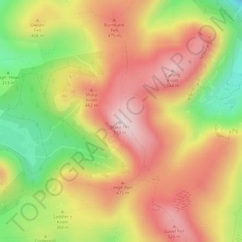
Carte topographique Blake Fell
Carte interactive
Cliquez sur la carte pour afficher l’altitude.
À propos de cette carte
Nom : Carte topographique Blake Fell, altitude, relief.
Altitude moyenne : 381 m
Altitude minimum : 153 m
Altitude maximum : 562 m
Autres cartes topographiques
Cliquez sur une carte pour visualiser sa topographie, son altitude et son relief.
Hard Knott
United Kingdom > England > Cumbria > Copeland
Hard Knott, Copeland, Cumbria, North West England, England, LA20 6EQ, United Kingdom
Altitude moyenne : 334 m
Pillar
United Kingdom > England > Cumbria > Copeland
Pillar, Copeland, Cumbria, North West England, England, CA23 3AX, United Kingdom
Altitude moyenne : 486 m