Cartes topographiques Alabama
Cliquez sur une carte pour visualiser sa topographie, son altitude et son relief.

Fairhope
United States > Alabama > Baldwin County > Fairhope
According to the U.S. Census Bureau, the city has a total area of 12.0 square miles (31.1 km2), of which 0.019 square mile (0.05 km2), or 0.16%, is water. Its elevation ranges from sea level at the bay to 122 feet (37 m) in the city center.
Altitude moyenne : 35 m




















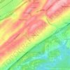
Hunters Hill
United States > Alabama > Jefferson County > Irondale > Hunters Hill
Altitude moyenne : 239 m


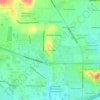

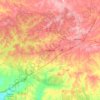
Auburn
United States > Alabama > Lee County > Auburn
The southwest and west regions of the city on the plateau are marked by rolling plains and savannahs, with the undeveloped portion primarily being used for cattle grazing and ranching. South of this region sits the coastal plain, with sandy soil and pine forest. Parts of north Auburn have much more rugged…
Altitude moyenne : 189 m