
Carte topographique Smithtown
Carte interactive
Cliquez sur la carte pour afficher l’altitude.
À propos de cette carte
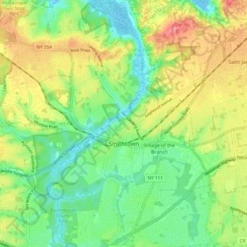
Nom : Carte topographique Smithtown, altitude, relief.
Lieu : Smithtown, Suffolk County, New York, 11787, United States (40.82676 -73.24826 40.89616 -73.16868)
Altitude moyenne : 29 m
Altitude minimum : 0 m
Altitude maximum : 69 m
Autres cartes topographiques
Cliquez sur une carte pour visualiser sa topographie, son altitude et son relief.
Smithtown Pines
United States > New York > Suffolk County > Smithtown
Smithtown Pines, Smithtown, Town of Smithtown, Suffolk County, New York, 11725, United States
Altitude moyenne : 29 m
Caleb Smith State Park
United States > New York > Suffolk County > Smithtown > Smithtown Pines
Caleb Smith State Park, Smithtown Pines, Smithtown, Town of Smithtown, Suffolk County, New York, United States
Altitude moyenne : 21 m