
Carte topographique Beltzville State Park
Carte interactive
Cliquez sur la carte pour afficher l’altitude.
Beltzville State Park
Beltzville State Park is a 2,972.39-acre (1,202.88 ha) Pennsylvania state park in Franklin and Towamensing townships, Carbon County, Pennsylvania in the United States. The park opened in 1972, and was developed around the U.S. Army Corps of Engineers flood control project Beltzville Dam on Pohopoco Creek. The village of Big Creek Valley was vacated in 1966 to make way for Beltzville Lake. Beltzville Lake is a 951.5 acres (385.1 ha) with 19.8 miles (31.9 km) of shoreline. Beltzville State Park is 5 miles (8.0 km) east of Lehighton just off U.S. Route 209. The park is at an elevation of 633 feet (193 m).
À propos de cette carte
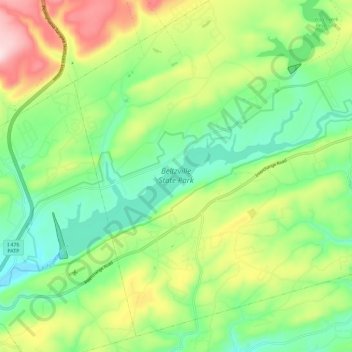
Nom : Carte topographique Beltzville State Park, altitude, relief.
Altitude moyenne : 274 m
Altitude minimum : 149 m
Altitude maximum : 499 m