
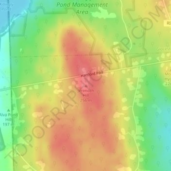
Carte topographique Jerimoth Hill
Carte interactive
Cliquez sur la carte pour afficher l’altitude.
À propos de cette carte
Nom : Carte topographique Jerimoth Hill, altitude, relief.
Altitude moyenne : 216 m
Altitude minimum : 176 m
Altitude maximum : 247 m
The hill is located on Route 101 in Foster, a half mile from the Connecticut line. To ascend the summit, for which there is a sign, there is a .3-mile (480 m) long trail that has a mere 10-foot (3.0 m) elevation gain. The hill is 812 feet (247 m) high and is located 15 miles (24 km) west of Providence, Rhode Island, and 35 miles (56 km) east of Willimantic, Connecticut.