
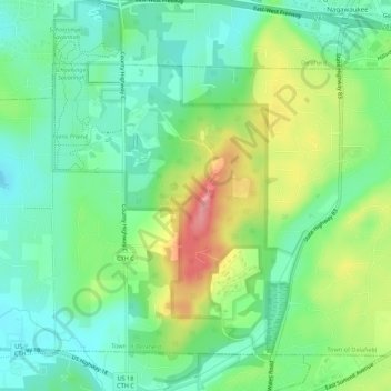
Carte topographique Kettle Moraine State Forest- Lapham Peak Unit
Carte interactive
Cliquez sur la carte pour afficher l’altitude.
À propos de cette carte
Nom : Carte topographique Kettle Moraine State Forest- Lapham Peak Unit, altitude, relief.
Altitude moyenne : 306 m
Altitude minimum : 271 m
Altitude maximum : 370 m
The park takes its name from a hill found within its borders. Lapham Peak has an elevation of 1,233 feet (376 m) above sea level, and is the highest point in Waukesha County. At the top of Lapham Peak is a wooden observation tower that is 45 feet (14 m) high and offers a dynamic view of southeastern Wisconsin and the northern edge of Illinois. The Waukesha County Historical Society named the peak in memory of Increase A. Lapham to honor his efforts in scientific study and his founding of the United States Weather Bureau.