
Carte topographique Bungaree
Carte interactive
Cliquez sur la carte pour afficher l’altitude.
À propos de cette carte
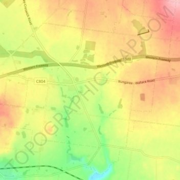
Nom : Carte topographique Bungaree, altitude, relief.
Lieu : Bungaree, Shire of Moorabool, Victoria, Australie (-37.59031 143.96210 -37.53173 144.04038)
Altitude moyenne : 569 m
Altitude minimum : 493 m
Altitude maximum : 634 m
Autres cartes topographiques
Cliquez sur une carte pour visualiser sa topographie, son altitude et son relief.
Mortat I33 Bushland Reserve
Australie > Victoria > Minimay
Mortat I33 Bushland Reserve, Minimay, Shire of West Wimmera, Victoria, 3413, Australie
Altitude moyenne : 142 m
Sebastopol
Australie > Victoria > Ballarat
Sebastopol, Ballarat, City of Ballarat, Grampians, Victoria, 3356, Australie
Altitude moyenne : 414 m
The Constitution
The Constitution, Alpine Shire, Hume, Victoria, Australie
Altitude moyenne : 599 m