
Carte topographique Woodburn
Carte interactive
Cliquez sur la carte pour afficher l’altitude.
À propos de cette carte
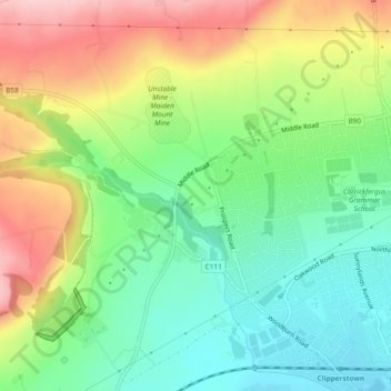
Nom : Carte topographique Woodburn, altitude, relief.
Altitude moyenne : 87 m
Altitude minimum : 10 m
Altitude maximum : 199 m
Autres cartes topographiques
Cliquez sur une carte pour visualiser sa topographie, son altitude et son relief.
Carrickfergus Castle
United Kingdom > Northern Ireland > Carrickfergus
Carrickfergus Castle, Marine Highway, Carrickfergus, County Antrim, Northern Ireland, BT38 7DF, United Kingdom
Altitude moyenne : 8 m