Géolocaliser

Carte topographique Ramgarh

Carte interactive

Cliquez sur la carte pour afficher l’altitude.

À propos de cette carte

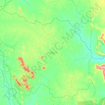
Nom : Carte topographique Ramgarh, altitude, relief.

Lieu : Ramgarh, Dumka, Jharkhand, Inde (24.40085 87.08536 24.63465 87.37272)

Altitude moyenne : 198 m

Altitude minimum : 111 m

Altitude maximum : 493 m

Autres cartes topographiques

Cliquez sur une carte pour visualiser sa topographie, son altitude et son relief.

Latehar

Inde > Jharkhand

Latehar, Jharkhand, 829206, Inde

Altitude moyenne : 452 m

Chainpur

Inde > Jharkhand > Chainpur

Chainpur, Gumla District, Jharkhand, 835206, Inde

Altitude moyenne : 804 m

Ramgarh

Inde > Jharkhand

Ramgarh, Jharkhand, 825316, Inde

Altitude moyenne : 426 m

Kodarma

Inde > Jharkhand

Kodarma, Jharkhand, Inde

Altitude moyenne : 271 m

Gumia

Inde > Jharkhand > Gumia

Gumia, Girīdīh, Giridih, Jharkhand, 829112, Inde

Altitude moyenne : 269 m

Ramgarh

Inde > Jharkhand

Ramgarh, Jharkhand, Inde

Altitude moyenne : 469 m

Latehar

Inde > Jharkhand > Latehar

Latehar, Jharkhand, 829206, Inde

Altitude moyenne : 393 m