
Carte topographique Lake Of The Ozarks
Carte interactive
Cliquez sur la carte pour afficher l’altitude.
À propos de cette carte
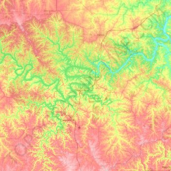
Nom : Carte topographique Lake Of The Ozarks, altitude, relief.
Altitude moyenne : 265 m
Altitude minimum : 163 m
Altitude maximum : 381 m
The lake was created by the construction of the 2,543-foot (775 m) long Bagnell Dam by the Union Electric Company of St. Louis, Missouri. The principal engineering firm was Stone and Webster. Construction began August 8, 1929, and was completed in April 1931; the lake reached spillway elevation on May 20, 1931.