
Carte topographique Rawdon Crematorium
Carte interactive
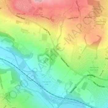
Cliquez sur la carte pour afficher l’altitude.
À propos de cette carte
Nom : Carte topographique Rawdon Crematorium, altitude, relief.
Altitude moyenne : 120 m
Altitude minimum : 42 m
Altitude maximum : 224 m
Autres cartes topographiques
Cliquez sur une carte pour visualiser sa topographie, son altitude et son relief.
Rawdon
United Kingdom > England > Leeds > Rawdon
Rawdon, Leeds, West Yorkshire, England, United Kingdom
Altitude moyenne : 131 m