
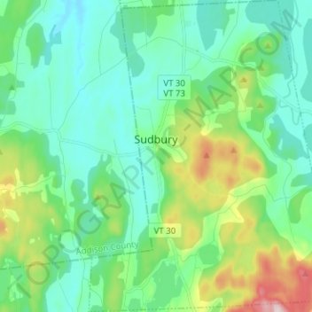
Carte topographique Sudbury
Carte interactive
Cliquez sur la carte pour afficher l’altitude.
À propos de cette carte
Nom : Carte topographique Sudbury, altitude, relief.
Lieu : Sudbury, Rutland County, Vermont, United States (43.74887 -73.23197 43.83967 -73.13148)
Altitude moyenne : 163 m
Altitude minimum : 80 m
Altitude maximum : 433 m
Autres cartes topographiques
Cliquez sur une carte pour visualiser sa topographie, son altitude et son relief.
Danby
United States > Vermont > Rutland County
Dorset Peak, part of the Taconic range, lies on the town's southern border and reaches an elevation of 3,804 feet (1,159 m). Danby quarry, located near the peak, opened in the early 20th century and is likely the world's largest underground marble quarry. It was reported in 2001 to have a total monthly output…
Altitude moyenne : 303 m
Valley Park
United States > Vermont > Rutland County > Killington > Sherburne Center
Altitude moyenne : 506 m