
Carte topographique Bucks Horn Oak
Carte interactive
Cliquez sur la carte pour afficher l’altitude.
À propos de cette carte
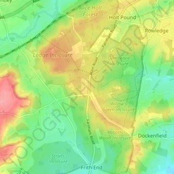
Nom : Carte topographique Bucks Horn Oak, altitude, relief.
Altitude moyenne : 99 m
Altitude minimum : 60 m
Altitude maximum : 151 m
Autres cartes topographiques
Cliquez sur une carte pour visualiser sa topographie, son altitude et son relief.
Blacknest
United Kingdom > England > Hampshire > East Hampshire > Binsted
Blacknest, Binsted, East Hampshire, Hampshire, England, GU34 4QD, United Kingdom
Altitude moyenne : 103 m