
Carte topographique Chaîne de l'Oberhalbstein
Carte interactive
Cliquez sur la carte pour afficher l’altitude.
À propos de cette carte
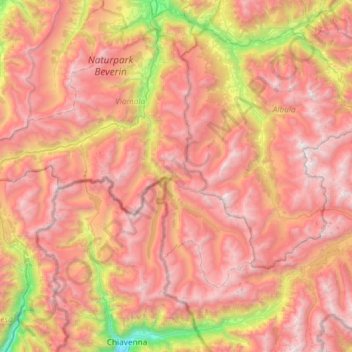
Nom : Carte topographique Chaîne de l'Oberhalbstein, altitude, relief.
Lieu : Chaîne de l'Oberhalbstein, Ferrera, Viamala, Grisons, Suisse (46.30807 9.32123 46.71259 9.66087)
Altitude moyenne : 2’032 m
Altitude minimum : 288 m
Altitude maximum : 3’361 m