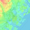
Carte topographique Savannah
Cliquez sur la carte pour afficher l’altitude.
Savannah
Savannah is characterized by a unique and varied topography shaped by its coastal location and historical development. The city is situated on a series of low bluffs along the Savannah River, which flows into the Atlantic Ocean approximately 18 miles (29 km) away. The terrain features a mix of flat coastal plains and gently rolling hills, with elevations typically ranging from 10 to 50 feet (3 to 15 meters) above sea level. This landscape is punctuated by marshlands, swamps, and numerous tidal creeks, which contribute to the area's rich biodiversity and ecosystem. The combination of these natural features has influenced the city's development and remains integral to its charm, as seen in its historic squares and parks, including the expansive Forsyth Park. The surrounding area also includes the Savannah National Wildlife Refuge, which showcases the region's ecological diversity.
À propos de cette carte
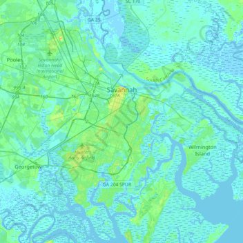
Nom : Carte topographique Savannah, altitude, relief.
Lieu : Savannah, Chatham County, Georgia, United States (31.88785 -81.37143 32.18966 -81.02952)
Altitude moyenne : 4 m
Altitude minimum : -5 m
Altitude maximum : 33 m
Autres cartes topographiques
Cliquez sur une carte pour visualiser sa topographie, son altitude et son relief.