
Carte topographique Crescent City
Carte interactive
Cliquez sur la carte pour afficher l’altitude.
À propos de cette carte
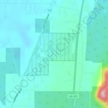
Nom : Carte topographique Crescent City, altitude, relief.
Lieu : Crescent City, Del Norte County, California, United States (41.84782 -124.16017 41.85846 -124.14190)
Altitude moyenne : 31 m
Altitude minimum : 2 m
Altitude maximum : 203 m
The topography of the sea floor surrounding Crescent City has the effect of focusing tsunamis. According to researchers at Humboldt State University and the University of Southern California, the city experienced tsunami conditions 31 times between the years 1933 and 2008. Although many of these incidents were barely perceptible, eleven events included wave measurements exceeding one meter, four events caused damage, and one event in particular is commonly cited as "the largest and most destructive recorded tsunami to strike the United States Pacific Coast."
Autres cartes topographiques
Cliquez sur une carte pour visualiser sa topographie, son altitude et son relief.
Crescent City
United States > California > Del Norte County
Crescent City, Del Norte County, California, 75531, United States
Altitude moyenne : 6 m
Craigs Creek
United States > California > Del Norte County
Craigs Creek, Del Norte County, California, United States
Altitude moyenne : 356 m
Crescent City
United States > California > Del Norte County > Crescent City
Crescent City, Del Norte County, California, United States
Altitude moyenne : 25 m