
Carte topographique Territorial waters of Greece - Gavdos and Gavdopoula
Carte interactive
Cliquez sur la carte pour afficher l’altitude.
À propos de cette carte
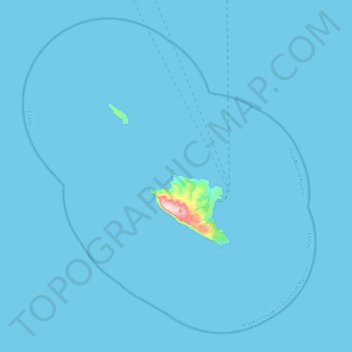
Nom : Carte topographique Territorial waters of Greece - Gavdos and Gavdopoula, altitude, relief.
Lieu : Territorial waters of Greece - Gavdos and Gavdopoula (34.70061 23.86226 35.03942 24.25673)
Altitude moyenne : 3 m
Altitude minimum : 0 m
Altitude maximum : 367 m