
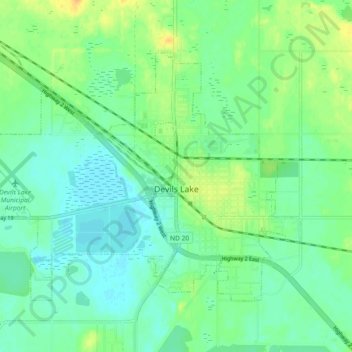
Carte topographique Devils Lake
Carte interactive
Cliquez sur la carte pour afficher l’altitude.
À propos de cette carte
Nom : Carte topographique Devils Lake, altitude, relief.
Altitude moyenne : 443 m
Altitude minimum : 433 m
Altitude maximum : 460 m
The first post office was founded November 15, 1882, and was originally named Creelsburg. It was founded by Lieutenant Heber M. Creel, a West Point graduate and topographical engineer stationed at nearby Fort Totten. After resigning from the U.S. Army, he surveyed the land and established the townsite.
Autres cartes topographiques
Cliquez sur une carte pour visualiser sa topographie, son altitude et son relief.
Channel A
United States > North Dakota > Ramsey County > Grand Harbor
Channel A, Grand Harbor, Ramsey County, North Dakota, United States
Altitude moyenne : 445 m
Six Mile Bay
United States > North Dakota > Ramsey County
Six Mile Bay, Ramsey County, North Dakota, United States
Altitude moyenne : 442 m