
Carte topographique Stock Hill
Carte interactive
Cliquez sur la carte pour afficher l’altitude.
À propos de cette carte
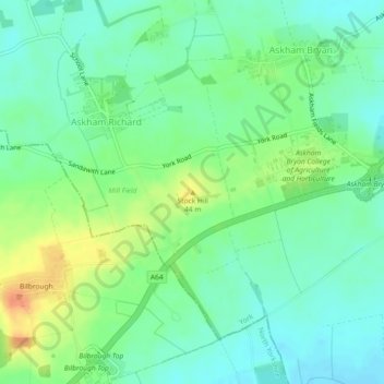
Nom : Carte topographique Stock Hill, altitude, relief.
Altitude moyenne : 28 m
Altitude minimum : 14 m
Altitude maximum : 53 m
Autres cartes topographiques
Cliquez sur une carte pour visualiser sa topographie, son altitude et son relief.
Rawcliffe
United Kingdom > England > York
Rawcliffe, York, Yorkshire and the Humber, England, United Kingdom
Altitude moyenne : 14 m
Airedale
United Kingdom > England > York
Airedale, Wentworth Way, Heslington, York, Yorkshire and the Humber, England, YO10 5NG, United Kingdom
Altitude moyenne : 136 m
Hogg's Pond
United Kingdom > England > York
Hogg's Pond, Chaloners Road, Woodthorpe, York, Yorkshire and the Humber, England, YO24 2TW, United Kingdom
Altitude moyenne : 14 m