
Carte topographique Newbury
Carte interactive
Cliquez sur la carte pour afficher l’altitude.
À propos de cette carte
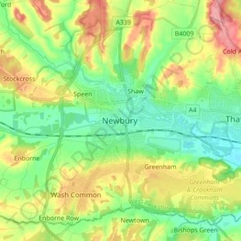
Nom : Carte topographique Newbury, altitude, relief.
Altitude moyenne : 102 m
Altitude minimum : 65 m
Altitude maximum : 162 m
Elevations vary from a minimum of 72m above mean sea level to 122m at Wash Common. Elevations reach 150-200m in the directly adjoining hills.