
Carte topographique Marlow
Carte interactive
Cliquez sur la carte pour afficher l’altitude.
À propos de cette carte
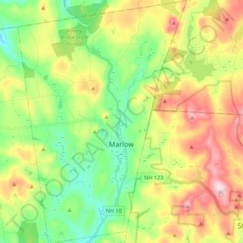
Nom : Carte topographique Marlow, altitude, relief.
Altitude moyenne : 446 m
Altitude minimum : 311 m
Altitude maximum : 648 m
According to the United States Census Bureau, the town has a total area of 26.4 square miles (68 km2), of which 26.0 sq mi (67 km2) is land and 0.5 sq mi (1.3 km2) is water, comprising 1.78% of the town. Marlow is drained by the Ashuelot River. The town's highest point is in its northeast corner, at the summit of Huntley Mountain, where the elevation reaches 1,978 feet (603 m) above sea level.