
Carte topographique Holly
Carte interactive
Cliquez sur la carte pour afficher l’altitude.
À propos de cette carte
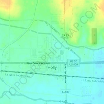
Nom : Carte topographique Holly, altitude, relief.
Lieu : Holly, Prowers County, Colorado, United States (38.04797 -102.13271 38.06447 -102.11864)
Altitude moyenne : 1’037 m
Altitude minimum : 1’028 m
Altitude maximum : 1’053 m
Holly is a statutory town in Prowers County in southeastern Colorado, United States. The town is located 4.3 miles (6.9 km) west of the Kansas border at an elevation of 3,393 feet (1,034 m). Despite having the lowest elevation of any Colorado municipality, Holly is higher than the high points of 19 states and the District of Columbia. The town population was 837 at the 2020 United States Census.
Autres cartes topographiques
Cliquez sur une carte pour visualiser sa topographie, son altitude et son relief.
Lamar
United States > Colorado > Prowers County
Lamar, Prowers County, Colorado, 81052, United States
Altitude moyenne : 1’118 m