
Carte topographique Kowloon
Carte interactive
Cliquez sur la carte pour afficher l’altitude.
À propos de cette carte
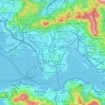
Nom : Carte topographique Kowloon, altitude, relief.
Lieu : Kowloon, Hong Kong, 000000, Chine (22.28228 114.13033 22.35841 114.24558)
Altitude moyenne : 93 m
Altitude minimum : -12 m
Altitude maximum : 590 m
Autres cartes topographiques
Cliquez sur une carte pour visualiser sa topographie, son altitude et son relief.
將軍澳 Tseung Kwan O
Chine > Hong Kong > 西貢區 Sai Kung District > 將軍澳 Tseung Kwan O
Altitude moyenne : 72 m