
Carte topographique Saipan
Carte interactive
Cliquez sur la carte pour afficher l’altitude.
À propos de cette carte
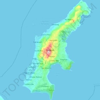
Nom : Carte topographique Saipan, altitude, relief.
Altitude moyenne : 22 m
Altitude minimum : 0 m
Altitude maximum : 462 m
The highest elevation on Saipan is a limestone-covered mountain called Mount Tapochau at 1,560 ft (480 m). Unlike many of the mountains in the Mariana Islands, it is not an extinct volcano but is a limestone formation.