
Carte topographique सराङ्गकोट
Carte interactive
Cliquez sur la carte pour afficher l’altitude.
सराङ्गकोट
Le Népal, terre d’altitude et de spiritualité, regorge de trésors naturels et culturels qui séduisent les voyageurs du monde entier. Parmi ces joyaux se trouve Sarangkot, un petit village perché à 1600 mètres d’altitude, à seulement quelques kilomètres de Pokhara.
À propos de cette carte
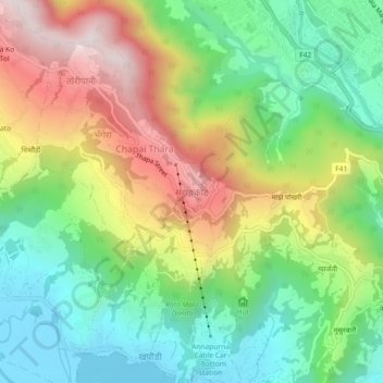
Nom : Carte topographique सराङ्गकोट, altitude, relief.
Lieu : सराङ्गकोट, Pokhara, कास्की, Gandaki, 00799, Népal (28.22452 83.92765 28.26452 83.96765)
Altitude moyenne : 1’139 m
Altitude minimum : 795 m
Altitude maximum : 1’657 m