Carte topographique Lord Howe Island
Carte interactive
Cliquez sur la carte pour afficher l’altitude.
À propos de cette carte
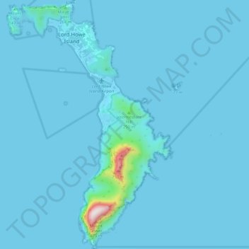
Nom : Carte topographique Lord Howe Island, altitude, relief.
Lieu : Lord Howe Island, New South Wales, 2898, Australia (-31.59794 159.03710 -31.51017 159.10546)
Altitude moyenne : 27 m
Altitude minimum : -2 m
Altitude maximum : 841 m
Autres cartes topographiques
Cliquez sur une carte pour visualiser sa topographie, son altitude et son relief.
The Herring Pools (Low tide only)
Australia > New South Wales > Lord Howe Island
The Herring Pools (Low tide only), Max Nichols Memorial Track, Lord Howe Island, New South Wales, 2898, Australia
Altitude moyenne : 12 m
Mount Gower
Australia > New South Wales > Lord Howe Island
Mount Gower, Lord Howe Island, New South Wales, 2898, Australia
Altitude moyenne : 120 m