
Faire un don
Équipez-vous pour votre prochaine aventure :
En tant que Partenaire Amazon, ce site perçoit une commission sur les achats éligibles sans surcoût pour vous.
Carte topographique Amazone
Cliquez sur la carte pour afficher l’altitude.
Faire un don
Équipez-vous pour votre prochaine aventure :
En tant que Partenaire Amazon, ce site perçoit une commission sur les achats éligibles sans surcoût pour vous.
Amazone
En fait, la source la plus lointaine de l’Amazone dans les Andes péruviennes n'a été fermement établie que récemment. C’est un ruisseau qui jaillit à 5 170 m d'une falaise située dans la région d'Arequipa sur un sommet de 5 507 m d’altitude, le Nevado Mismi, approximativement à 160 km à l'ouest du lac Titicaca et environ à 650 km au sud-est de Lima. Cette montagne fut suggérée pour la première fois comme la véritable source en 1971 par une expédition américaine dirigée par Moren McIntyre, mais ne fut pas confirmée avant décembre 2000 par Andrew Pietowski, et encore en 2001.
Faire un don
Équipez-vous pour votre prochaine aventure :
En tant que Partenaire Amazon, ce site perçoit une commission sur les achats éligibles sans surcoût pour vous.
À propos de cette carte
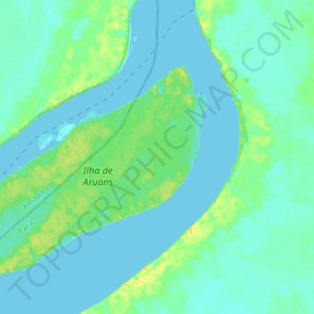
Nom : Carte topographique Amazone, altitude, relief.
Altitude moyenne : 5 m
Altitude minimum : -4 m
Altitude maximum : 24 m
Faire un don
Équipez-vous pour votre prochaine aventure :
En tant que Partenaire Amazon, ce site perçoit une commission sur les achats éligibles sans surcoût pour vous.